How 'fire-generated thunderstorms' make wildfires more deadly
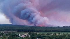
What if the wildfires you’ve heard about are more than just flames and smoke? What if they could actually create their own weather?
This phenomenon, known as pyrocumulonimbus, has been described by NASA as the "fire-breathing dragon of clouds." It occurs when extreme heat from a wildfire causes water vapor to rise rapidly, forming towering clouds that can lead to thunderstorms. These fire-generated storms can unleash powerful winds, lightning strikes, and even more intense heat, making already dangerous wildfires even deadlier.
Why should you care? As wildfires become more frequent and severe due to climate change, understanding their impact on weather patterns is crucial. These unpredictable weather events can not only intensify existing fires but also spark new ones, complicating firefighting efforts and endangering lives and property.
Additionally, pyrocumulonimbus clouds can lead to hazardous air quality and unpredictable weather, affecting communities far beyond the fire's immediate vicinity. This means the fallout from a wildfire isn't just localized; it can extend across regions, impacting thousands of lives.
So, what drives the formation of these fire-induced thunderstorms? The interaction between intense heat, moisture, and atmospheric conditions plays a key role. As the climate continues to warm, the conditions that foster these dangerous weather patterns may become more common, posing new challenges for emergency responders and communities.
Understanding these dynamics is essential for better preparedness and response strategies. The more we know about how wildfires generate their own weather, the better equipped we can be to face the challenges they present.
To stay informed on this evolving topic, consider reading the full report for the latest verified details.
BBC World · ✦ 24ScopeNews AI